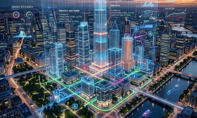
Cities are growing rapidly, and managing urban infrastructure is becoming more complex every year. From traffic congestion and water shortages to energy consumption and waste management, city planners face several challenges while trying to create safer and more sustainable communities. Traditional planning methods often rely on historical records and physical inspections, which may not provide a complete picture of what is happening across a city.
This is where digital twins for smart cities are making a difference. A digital twin is a virtual representation of a real-world object, system, or environment. In an urban setting, it can represent buildings, roads, bridges, power networks, water systems, and even entire neighborhoods.
By combining real-time data, sensors, mapping technologies, and computer simulations, digital twins help city authorities understand existing conditions and explore possible outcomes before making important decisions. Instead of relying entirely on assumptions, planners can use digital models to test ideas and identify potential problems.
What Are Digital Twins in Smart Cities?
A digital twin is more than a three-dimensional model of a city. It can connect a virtual representation of infrastructure with information collected from the physical environment. Depending on the system, this information may include traffic movement, energy consumption, weather conditions, water usage, building occupancy, and equipment performance.
For example, a digital twin of a busy road could combine traffic sensor readings, signal timings, road layouts, and historical congestion data. Planners could use the model to examine how changing a traffic signal or introducing a new road connection might affect vehicle movement.
Similarly, a digital twin of a water distribution network could help engineers understand pressure changes, identify unusual usage patterns, and investigate possible leaks.
The main purpose is to create a data-driven view of urban systems so that decision-makers can understand how different parts of a city interact.
How Digital Twins Simulate Urban Infrastructure
Digital twins work by connecting physical infrastructure with digital models and analytical tools. The exact setup depends on the city’s needs, available data, and technical capabilities.
1. Collecting Data From the Physical City
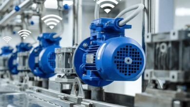
The process begins with data collection. Sensors, Internet of Things (IoT) devices, GPS systems, satellites, utility meters, and connected infrastructure can provide information about urban conditions.
For instance, traffic sensors may measure vehicle movement, while smart meters can record electricity or water consumption. Geographic information systems (GIS) provide location-based information about roads, buildings, and public facilities.
The quality of a digital twin depends heavily on the accuracy, consistency, and availability of this data.
2. Building a Virtual Representation
Collected data is organized into a digital model of the relevant infrastructure. This model may represent a single building, a transportation network, a power grid, or a larger urban area.
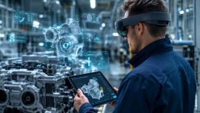
Three-dimensional mapping and building information modeling can help describe physical structures. Simulation software and data platforms can add information about how those structures operate.
A useful digital twin does not always need to represent an entire city. A focused model of a drainage system or public transport corridor can also provide valuable insights.
3. Running Simulations and Testing Scenarios
Once the model is connected to relevant data, planners can use simulations to explore different situations.
For example, they might examine how a new residential development could affect road congestion, whether a drainage network could handle intense rainfall, or how increased electricity demand could affect local distribution infrastructure.
These simulations allow authorities to compare possible decisions before investing in physical construction or making operational changes.
However, the results are only as reliable as the model’s assumptions, input data, and representation of real-world conditions.
4. Monitoring Conditions and Updating the Model
Where real-time connections are available, a digital twin can update as new information arrives. This helps operators compare expected performance with actual conditions and investigate unusual changes.
Not every digital twin updates continuously. Some use periodic data updates or are designed mainly for planning and scenario analysis. The appropriate approach depends on the intended use.
Key Applications of Digital Twins in Smart Cities
Traffic Management and Transportation
Traffic congestion wastes time, increases fuel consumption, and affects the quality of urban life. Digital twins can help transportation teams study traffic patterns, evaluate road designs, and test changes to signal timings.
A city could simulate the effects of closing a road for maintenance or adding a dedicated bus lane. The results may help planners anticipate alternative traffic routes and identify possible bottlenecks.
Digital twins can also support public transport planning by helping authorities assess passenger demand, route connections, and infrastructure capacity.
Energy Management and Smart Buildings
Buildings and public infrastructure account for a substantial share of urban energy use. Digital twins can bring together information about building systems, electricity demand, equipment performance, and environmental conditions.
For example, a building digital twin may help facility managers identify inefficient heating or cooling schedules. At a wider scale, urban energy models can help planners explore the effects of new developments, renewable energy installations, and changing electricity demand.
These insights can support more efficient energy planning, although actual savings depend on the quality of the analysis and the actions taken afterward.
Water Supply and Wastewater Systems
Reliable water infrastructure is essential for growing cities. Digital twins can help utilities examine water distribution networks, monitor pressure, and assess how changes in demand affect service delivery.
When combined with suitable sensor data, models may help identify areas where water loss is suspected or where maintenance should receive priority.
Digital simulations can also support drainage planning by examining how rainfall, surface conditions, and drainage capacity interact during heavy storms. They cannot eliminate flood risk, but they can help authorities evaluate different preparedness and infrastructure options.
Urban Planning and Sustainable Development
Before approving a large development project, city planners need to consider its potential effect on transport, utilities, public spaces, and surrounding neighborhoods.
A digital twin can bring these elements together in a shared planning environment. Officials may compare alternative building layouts, estimate infrastructure demand, and study how proposed changes could affect sunlight, land use, or mobility.
This approach can improve coordination between departments and help identify conflicts earlier in the planning process.
Disaster Preparedness and Emergency Response
Floods, heatwaves, fires, and other emergencies can place significant pressure on urban infrastructure. Digital twins can support preparedness by simulating selected hazards and examining how essential services may be affected.
For example, a flood model linked to urban terrain and drainage information can help planners identify areas that may require improved drainage or evacuation planning.
Emergency teams can also use infrastructure models to understand the location of critical facilities and assess potential service disruptions. Reliable emergency decisions still require validated models, current information, and established response procedures.
Benefits of Digital Twins for Smart Cities
Digital twins offer several potential benefits when implemented with clear objectives and reliable data.
- Better planning decisions: Authorities can compare scenarios and understand potential consequences before committing resources.
- Improved infrastructure maintenance: Operational data can help identify unusual performance and prioritize inspections.
- More efficient resource use: Models can support analysis of energy demand, water distribution, and transport capacity.
- Stronger coordination: Departments can work with a shared representation of connected urban systems.
- Support for sustainability goals: Simulations can help evaluate strategies for reducing resource consumption and improving urban resilience.
- Reduced uncertainty: Testing different scenarios can reveal risks that may be difficult to identify through conventional planning alone.
These benefits are not automatic. They depend on how well the technology is integrated into daily operations and whether city teams have the skills and resources to act on its findings.
Challenges in Implementing Urban Digital Twins
Despite their potential, digital twins introduce technical, financial, and governance challenges.
Data Quality and Integration
Information may come from different departments, sensors, contractors, and legacy systems. Differences in formats, update schedules, and accuracy can make integration difficult. Poor-quality data can lead to misleading simulation results.
High Implementation Costs
Developing and maintaining a digital twin may require sensors, software, cloud infrastructure, skilled professionals, and long-term technical support. Cities may need to begin with smaller projects to demonstrate value before expanding the system.
Privacy and Cybersecurity
Urban models can contain sensitive information about buildings, public infrastructure, transport patterns, or connected devices. Authorities must establish appropriate access controls, data protection practices, and cybersecurity safeguards.
Personal information should be minimized or protected wherever possible, particularly when data could reveal individual movements or behavior.
Technical Skills and Collaboration
Digital twins often require cooperation between urban planners, civil engineers, data analysts, IT teams, and public agencies. Without clear responsibilities and suitable training, even technically advanced systems may remain underused.
Keeping Models Accurate
Cities constantly change as roads are repaired, buildings are constructed, and infrastructure ages. Digital models must be updated and validated to remain useful. An outdated twin may not accurately represent current conditions.
The Future of Digital Twins in Smart Cities
The future of urban digital twins will likely involve closer integration with artificial intelligence, IoT networks, geospatial technologies, and advanced simulation tools.
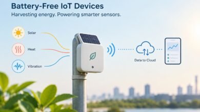
AI may help analyze large datasets, detect unusual patterns, and estimate future infrastructure demand. IoT devices can provide more frequent observations, while improved computing capabilities can make complex simulations easier to run.
Another important development is the creation of connected models across different urban systems. A transportation project, for example, can affect electricity demand, air quality, public safety, and land use. Linking these systems may help planners understand consequences that would otherwise be considered separately.
However, successful adoption will require more than advanced software. Cities will need transparent governance, dependable data, cybersecurity protections, and clear ways to measure whether digital twins improve public services.
Rather than building one enormous model immediately, many cities may benefit from starting with a specific challenge, measuring the results, and expanding only when the approach proves useful.
Conclusion
Digital twins are changing how cities can understand and plan their infrastructure. By connecting real-world information with virtual models, they allow planners to simulate possible changes, investigate risks, and make better-informed decisions about transportation, energy, water, buildings, and public safety.
Although implementation requires investment, reliable data, technical expertise, and strong security practices, digital twins can provide a valuable foundation for more responsive and sustainable urban development.
As cities continue to grow, the ability to test ideas digitally before applying them in the physical world could become an increasingly important part of modern infrastructure planning. The real value of a digital twin lies not simply in creating a virtual city, but in using that model to solve practical urban problems.
Frequently Asked Questions
1. What are digital twins in smart cities?
Digital twins are virtual models of urban infrastructure that use data to monitor conditions and simulate possible changes.
2. How do digital twins improve urban planning?
They help planners test infrastructure projects, analyze traffic, and evaluate resource requirements before implementation.
3. Can digital twins reduce city traffic?
Yes. They can simulate traffic patterns and evaluate road layouts or signal timing changes to support better traffic management.
4. What are the challenges of digital twins?
Major challenges include implementation costs, data quality, cybersecurity, privacy protection, and ongoing model maintenance.