Geospatial Technology in Healthcare: Mapping the Path to Better Care

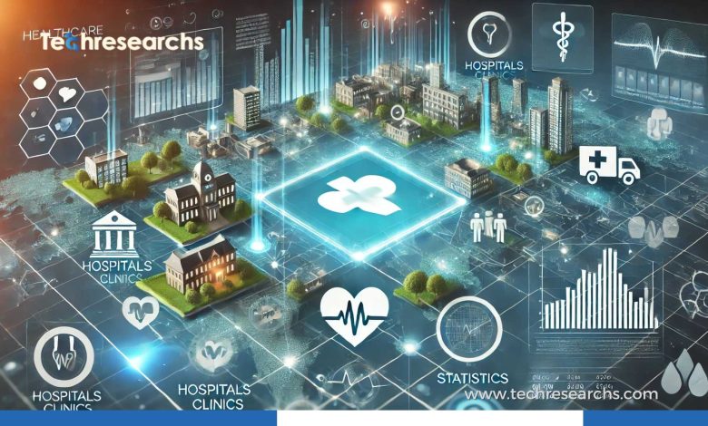
Healthcare is not only about what happens inside a hospital. Where people live, how far they travel for treatment, the environment around them, and the availability of medical services can all influence their health.
This is where geospatial technology in healthcare is making a difference.
By connecting healthcare information with location data, doctors, researchers, and public-health teams can see patterns that may otherwise remain hidden. A map can reveal communities with limited access to healthcare, areas experiencing disease outbreaks, or places where environmental conditions may be affecting public health.
In simple terms, geospatial technology helps healthcare professionals understand the connection between people, places, and health.
What Is Geospatial Technology in Healthcare?
Geospatial technology is a collection of tools used to capture and understand information based on location. In healthcare, these tools can turn complex datasets into maps and visual patterns that are easier to analyze.
Common technologies include:
- Geographic Information Systems (GIS)
- GPS and location-based services
- Satellite imagery
- Remote sensing
- Digital mapping
- Spatial databases
- Geospatial analytics
- Artificial intelligence and GeoAI
The important part is not the map itself. The real benefit comes from combining location data with useful healthcare information.
For example, imagine a city where several neighborhoods have high rates of a particular illness. A geospatial analysis could compare those locations with air quality, population density, access to healthcare, transportation, and other relevant factors. That broader view may give researchers a better understanding of what is happening.
Why Location Matters in Healthcare
Two people can have very different healthcare experiences even when they live in the same city.
One person might live a few minutes from a hospital, while another may need to travel for an hour to reach basic medical care. Someone living near a polluted industrial area may also face different environmental exposures from someone living in a cleaner part of the city.
Traditional healthcare data can tell us who is sick and what condition they have. Geospatial data adds another important question:
Where is this happening?
That additional perspective can help healthcare organizations make better decisions.
1. Tracking and Understanding Disease
Disease does not always spread evenly across a population.
Public-health teams can use geospatial mapping to see where cases are concentrated and whether clusters are developing in particular areas. Combining case information with demographic, environmental, and mobility data can provide additional context.
This can be useful during infectious disease outbreaks, but spatial analysis also has applications in studying longer-term health trends.
Instead of looking at thousands of individual records separately, researchers can visualize broader geographic patterns and decide where further investigation may be worthwhile.
2. Finding Gaps in Healthcare Access
Building more healthcare facilities does not automatically solve access problems.
A facility might exist within a particular region, but some communities could still struggle to reach it because of distance, transportation limitations, road conditions, or population distribution.
Geospatial analysis can highlight these gaps.
Healthcare planners can examine factors such as:
- Distance to hospitals
- Travel time
- Population density
- Public transportation
- Location of primary-care centers
- Distribution of specialists
- Emergency response times
This information can help decision-makers determine where new facilities, clinics, mobile healthcare services, or other resources could be useful.
3. Helping Emergency Services Respond Faster
In an emergency, every minute matters.
Geospatial systems can help emergency teams understand where incidents are occurring, which hospitals are nearby, and which routes may provide the fastest access.
During large-scale emergencies such as floods, earthquakes, fires, or disease outbreaks, maps can also help authorities identify affected areas and prioritize resources.
Instead of relying solely on static information, modern systems can combine geographic data with changing conditions to give responders a clearer picture of what is happening on the ground.
4. Connecting Health With the Environment
Our surroundings can have a major impact on health.
Air pollution, extreme heat, poor water quality, flooding, and other environmental conditions can affect communities differently depending on where they live.
Geospatial technology allows researchers to compare health information with environmental datasets.
For example, researchers might examine whether certain respiratory health problems appear more frequently in areas with higher levels of air pollution. This does not automatically prove that pollution caused the health problem, but it can reveal patterns that deserve further study.
How GIS Supports Healthcare Decisions
Geographic Information Systems, or GIS, are among the most useful technologies in this field.
Think of GIS as a way to place different types of information on top of the same geographic map.
One layer might show hospitals. Another could show population density. A third might display transportation networks, while another could represent disease statistics.
When these layers are analyzed together, healthcare planners can see relationships that are difficult to understand from spreadsheets alone.
For instance, a district may appear to have enough healthcare facilities when you simply count hospitals. Once population size and travel time are added to the analysis, however, it may become clear that some communities remain poorly served.
Geospatial Technology in Public Health
Public-health organizations have particularly strong reasons to use location-based information.
Mapping can support disease surveillance, vaccination planning, health campaigns, sanitation programs, and community health assessments.
During an outbreak, geographic information can help teams monitor where cases are appearing and whether the affected area is changing over time.
This can help public-health officials decide where additional testing, education, medical support, or other interventions may be appropriate.
Still, maps should be treated as one part of the decision-making process. Public-health professionals need to combine geospatial findings with clinical evidence, epidemiological research, and information from communities.
The Role of Satellite Data
Healthcare researchers can also benefit from information collected through satellites.
Satellite and remote-sensing technologies can provide large-scale information about environmental conditions such as land use, vegetation, surface temperature, flooding, and other geographic characteristics.
This is particularly useful in areas where collecting detailed information on the ground is difficult or expensive.
When this environmental information is compared with health data, researchers can investigate possible connections between environmental conditions and health outcomes.
How AI Is Changing Geospatial Healthcare
Artificial intelligence is adding another layer of capability to geospatial analysis.
Modern AI systems can process large volumes of geographic and healthcare-related information, identify patterns, and assist with predictive analysis.
For example, healthcare planners could potentially use AI-assisted models to estimate where demand for medical services may increase or identify geographic patterns that deserve closer attention.
But AI is not a magic solution.
A prediction is only as useful as the data behind it. If the data is incomplete, outdated, or biased, the resulting model may also produce unreliable conclusions.
Human expertise remains essential when interpreting geospatial AI results.
Key Benefits of Geospatial Technology in Healthcare
The technology can offer several practical benefits.
Better Resource Planning
Healthcare organizations can identify areas where additional facilities, staff, equipment, or services may be needed.
Improved Healthcare Accessibility
Travel-time and location analysis can reveal communities that face barriers to reaching medical services.
Stronger Disease Surveillance
Geographic patterns can help public-health teams monitor disease distribution and changing trends.
More Effective Emergency Planning
Location data can support faster coordination and better resource allocation during emergencies.
Deeper Health Research
Researchers can explore relationships between health outcomes, geography, demographics, and environmental conditions.
Challenges Healthcare Organizations Need to Consider
Geospatial technology also comes with important challenges.
Protecting Patient Privacy
Location data can become highly sensitive when it is connected to individual health records. Strong privacy protections and careful data governance are therefore essential.
Maintaining Data Accuracy
Maps and datasets need to be regularly updated. Incorrect addresses, outdated population information, or incomplete healthcare records can affect the quality of an analysis.
Avoiding Bias
If certain communities are poorly represented in the data, geospatial models may produce an incomplete picture of their healthcare needs.
Managing Technical Complexity
Effective geospatial systems require people who understand GIS, healthcare data, analytics, privacy, and technology infrastructure.
Interpreting Results Carefully
A pattern on a map does not necessarily mean that one factor caused another. Geographic relationships need to be investigated rather than automatically treated as proof of causation.
What Could Come Next?
The future of geospatial healthcare will likely involve more connections between GIS, artificial intelligence, remote sensing, connected devices, healthcare analytics, and real-time data.
This could move healthcare planning beyond simply asking where problems are happening.
The bigger goal could be understanding why certain patterns appear in particular places and how healthcare systems can respond more effectively.
For example, advanced simulations could help planners evaluate potential locations for new healthcare facilities before construction begins. Real-time mapping could support emergency teams during rapidly changing situations. AI could help researchers analyze geographic relationships across much larger datasets.
These technologies could make healthcare planning more proactive rather than purely reactive.
Final Thoughts
Geospatial technology is changing the way healthcare professionals think about health and access to care.
A patient’s location can influence how easily they reach a doctor, what environmental risks they experience, and how quickly emergency services can respond. By bringing geographic information into healthcare decision-making, organizations can gain a more complete understanding of these challenges.
The real promise of geospatial technology is not simply creating better maps. It is using location-based insights to make smarter healthcare decisions, improve access, support public health, and ultimately serve communities more effectively.
As healthcare becomes increasingly connected and data-driven, understanding the relationship between health and place could become just as important as understanding the medical condition itself.
Frequently Asked Questions
What is geospatial technology in healthcare?
Geospatial technology in healthcare uses location-based data, GIS, mapping, GPS, satellite imagery, and spatial analytics to understand health patterns and improve healthcare planning.
How does geospatial technology improve healthcare?
It can help identify underserved communities, track disease patterns, plan healthcare facilities, improve emergency response, and understand environmental factors affecting health.
How is GIS used in healthcare?
GIS helps healthcare professionals combine geographic information with health data to visualize disease distribution, healthcare accessibility, population trends, and resource requirements.
What are the challenges of using geospatial technology in healthcare?
Key challenges include patient privacy, data accuracy, cybersecurity, potential bias, technical complexity, and careful interpretation of geographic patterns.